
WARNING: This guide was written by hoojoo on steam and i am simply reposting it here, The information could be completely innacurate, follow at your own risk. (Source: Steam Community :: Guide :: A Guide on Custom Heightmaps )
In this guide I will go over how to create your own custom heightmap as well as provide some ones I have already made which include:
- An asteroid heightmap
- And a large crater heightmap
Free to use as long as credit is given.
This guide will be updated over some time if I find new things about heightmaps.
The Basics
Creating The Height-map
If you are trying to create a realistic height-map for planets that contains geographical features such as oceans and mountains then you can use the polar plot shown below. Simply open an image editing software, such as Photoshop, and overlay it on your planet texture.
After that, in the same or different software, such as adobe illustrator,
use the ruler shown below to draw your height-map to match the polar plot.
Make sure to save the height-map as .jpeg or .png file format and save it in Heightmap Data of your solar system.
Note: Overhangs aren't achievable in SFS. So make sure your height-map doesn't have any before saving.
Polar Plot:
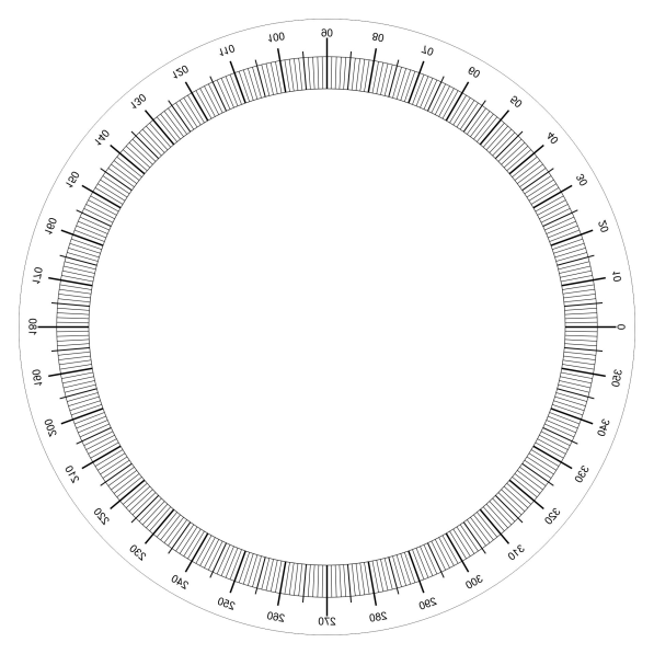
Ruler:

Inputting The Height-map
Now, you must know how to make it actually work on your planet, otherwise the height-map will glitch and not be outputted properly.
To do this you need to use the following equation:
2 * π * radius of planet
This gives you the circumference of your planet.
Once you have the value, head into the .txt file of your planet and do the following:
1. Find the terrainFormulaDifficulties information.
2. In the first output replace Perlin with the name of your height-map and file format that you saved your height-map with (should be .jpeg or .png).
3. The first numbers after the first comma (ex. 543495.5290710), replace it with the value you got from the equation.The second number after the 2nd comma is just how tall your height-map will be in-game.Congratulations, you just made your first ever height-map!
Free Heightmaps
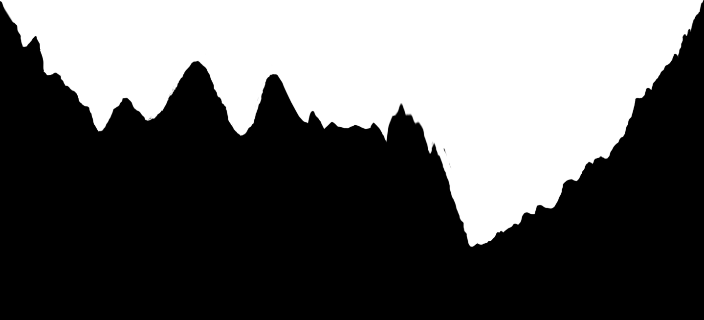
Asteroid
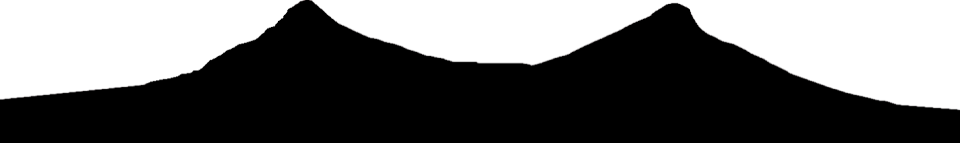
Crater
Credits
Mario#2046 for the polar plot and ruler as well as helping me understand heightmaps.
{Mariohobbs note: His height map example images are in black so the auto dark mode makes em look invisible, Download the images and you should be able to see em}
In this guide I will go over how to create your own custom heightmap as well as provide some ones I have already made which include:
- An asteroid heightmap
- And a large crater heightmap
Free to use as long as credit is given.
This guide will be updated over some time if I find new things about heightmaps.
The Basics
Creating The Height-map
If you are trying to create a realistic height-map for planets that contains geographical features such as oceans and mountains then you can use the polar plot shown below. Simply open an image editing software, such as Photoshop, and overlay it on your planet texture.
After that, in the same or different software, such as adobe illustrator,
use the ruler shown below to draw your height-map to match the polar plot.
Make sure to save the height-map as .jpeg or .png file format and save it in Heightmap Data of your solar system.
Note: Overhangs aren't achievable in SFS. So make sure your height-map doesn't have any before saving.
Polar Plot:
Ruler:
Inputting The Height-map
Now, you must know how to make it actually work on your planet, otherwise the height-map will glitch and not be outputted properly.
To do this you need to use the following equation:
2 * π * radius of planet
This gives you the circumference of your planet.
Once you have the value, head into the .txt file of your planet and do the following:
1. Find the terrainFormulaDifficulties information.
2. In the first output replace Perlin with the name of your height-map and file format that you saved your height-map with (should be .jpeg or .png).
3. The first numbers after the first comma (ex. 543495.5290710), replace it with the value you got from the equation.The second number after the 2nd comma is just how tall your height-map will be in-game.Congratulations, you just made your first ever height-map!
Free Heightmaps
Asteroid
Crater
Credits
Mario#2046 for the polar plot and ruler as well as helping me understand heightmaps.
{Mariohobbs note: His height map example images are in black so the auto dark mode makes em look invisible, Download the images and you should be able to see em}